
Far North Queensland is reeling after being pummelled by torrential, record-breaking rainfall, triggering widespread flash flooding and urgent warnings from emergency services.
Torrential Downpour Smashes Records
The intense weather system, which settled over the region on Monday, dumped phenomenal amounts of rain in a short period. The Bureau of Meteorology confirmed that several locations experienced their highest daily rainfall totals for April in over a century of records.
The standout was the Cairns suburb of Redlynch, which recorded a staggering 301 millimetres of rain in just 24 hours. This deluge smashed the previous April daily record of 298mm set back in 1915. Other areas were similarly drenched, with Kairi receiving 223mm and Mareeba 163mm.

"The rainfall totals we've seen are exceptional for this time of year," a Bureau spokesperson said. The downpour was driven by a deep, slow-moving trough combined with very moist onshore winds, creating the perfect conditions for severe rainfall.
Flash Flooding and Community Impact
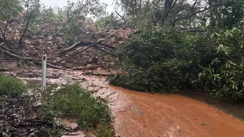
The immediate consequence of the record rain was dangerous flash flooding. Roads were rapidly cut off, with floodwaters making many routes impassable. Residents in low-lying areas were urged to prepare for possible isolation and to avoid all unnecessary travel.
Emergency services were kept busy responding to numerous incidents. Queensland Fire and Emergency Services (QFES) reported multiple calls for assistance related to flooding. Social media was flooded with images and videos of submerged streets, overflowing drains, and fast-flowing water across suburbs like Brinsmead and Kanimbla.
A severe weather warning for heavy rainfall remained active for parts of the North Tropical Coast and Tablelands districts. The warning highlighted the continued risk of dangerous and life-threatening flash flooding, as well as the potential for landslides.
Ongoing Warnings and the Forecast Ahead
Authorities have stressed that the situation remains dynamic and potentially dangerous. A flood watch is current for coastal catchments from Cooktown to Ingham, meaning people in these areas need to stay alert.
The key advice from QFES and the Bureau of Meteorology is clear:
- Do not drive, walk, or ride through floodwaters.
- Keep informed by monitoring official warnings and forecasts.
- Have an emergency plan ready if you are in a flood-prone area.
While the intense rainfall is expected to gradually ease from Tuesday, showers and storms are forecast to continue across the region. The ground is now saturated, meaning any further rain could quickly lead to renewed flooding. The community is being told to remain vigilant as the clean-up begins and to follow all advice from local authorities.


