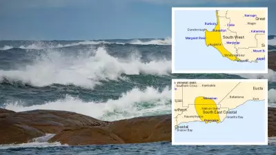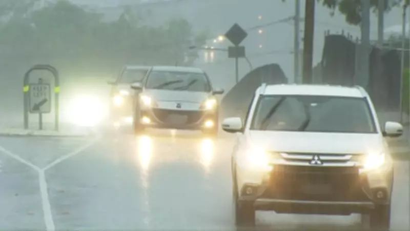
Parts of Queensland and northern New South Wales experienced significant rainfall overnight, with conditions expected to worsen as the deluge intensifies. The Bureau of Meteorology (BOM) has issued flash flooding and heavy rainfall warnings for South East Queensland, including Brisbane metro, the Gold Coast, and Sunshine Coast, as well as areas in the northern rivers of NSW.
Meteorologist Insights on Storm Development
Senior Meteorologist Miriam Bradbury noted that it was a wet night across much of northeast NSW and Queensland. "We saw thunderstorms developing through Thursday afternoon across central parts of Queensland, as well as across parts of northeast NSW," she said. "Through the later part of the afternoon, these storms shifted eastwards, pushing into the southeast coast of Queensland as well."
Bradbury explained that a trough sweeping up the NSW coast helped trigger these storms, particularly in the northern rivers region, by interacting with moisture in the area.

Recorded Rainfall Totals
In northern NSW, between 9am Thursday and 6am Friday, the BOM recorded substantial rainfall: 178mm at Green Pigeon, 131mm at Mullumbimby, and 125mm at Yalgun Creek. In Queensland, intense downpours included 72mm in just one hour at Mount Playfair, 87mm at Nooga Nooga near Roma, and 82mm at Goomburra near Gympie.
Continued Heavy Rain and Flood Risks
Bradbury warned that there will be no reprieve for parts of southeast Queensland and northern NSW, as heavy rain is set to settle in on Friday. "The highest rainfall totals are likely to be tied to thunderstorms today," she stated. "For Queensland, the focus for showers and storms will be across the southern two-thirds of the state, with severe storms and heavy falls possible. Those heaviest falls are most likely about the coast and the coastal ranges in the southeast."
Flash flooding is a major concern over the coming days, with warnings in place for areas including Brisbane, Gold Coast, and Sunshine Coast. Bradbury highlighted that warnings flag six-hourly rainfall totals of 50mm to 90mm, with isolated totals as high as 150mm. "Now this much rain coming in such a short space of time is likely to lead to flash flooding across these areas," she said. "That means roads, walkways and properties may see localised inundation and we could see extremely dangerous conditions out on the roads as well as possible power outages and traffic and transport delays."
Flood Watches and Preparedness Measures
Flood watches have been issued for broad parts of southern and southeast Queensland, along the coast from Bundaberg to the NSW border, and as far south as Ballina. In response, sandbagging stations have been set up by local councils across multiple areas in southeast Queensland, including Moreton Bay, Redland, and the Gold Coast.
Weekend Forecast and Severe Storm Potential
Rain is forecast to continue on both Saturday and Sunday across much of eastern and central Queensland. "We'll see an ongoing risk of locally heavy falls across the southeast through the weekend as well," Bradbury said. "But the greatest risk of those highest totals is likely to gradually contract away from the southeast to central parts of Queensland."
Severe thunderstorms are possible on Friday and into the weekend. However, Bradbury noted that separate severe thunderstorm warnings will be issued by the BOM "if we see very dangerous thunderstorms with more intense rainfall developing."