The Western Australian Government is significantly expanding its control over housing development around train stations, with Planning and Lands Minister John Carey confirming more station precincts along the Fremantle line will soon fall under State authority.
First Wave of Station Precincts Announced
Last week, the State Government revealed that 10 train station precincts across Perth would come under the direct planning control of the WA Planning Commission. This initial list includes Swanbourne, Cottesloe, and Mosman Park stations, all located within the western suburbs corridor.
The controversial move aims to fast-track medium to high-density housing development within an 800-metre radius of these key transport hubs. Mr Carey defended the decision, stating that decades after the Fremantle line's reopening, density along this public transport corridor remains unacceptably low.

Local Government Backlash and Future Expansion
The announcement has been met with confusion and disappointment from affected local governments. Councils fear their own precinct structure plans, developed through extensive community consultation and at significant cost to ratepayers, will now be overridden by state-level planning controls.
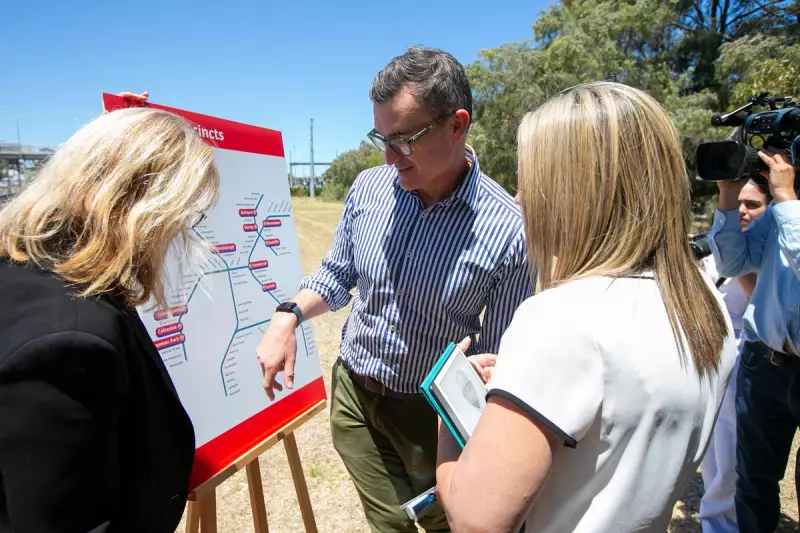
Mr Carey told Western Suburbs Weekly that the government is planning additional station precinct takeovers in the future, with a specific focus on the Fremantle line. "These are the first 10 station precincts and more will be added in the future," he confirmed during the announcement at Cottesloe train station alongside Transport Minister Rita Saffioti.
Which Stations Are Next?
While the government hasn't officially named the next stations to come under state control, several factors provide clues about future targets. Mr Carey mentioned the state considered current planning frameworks, availability of government land, development potential, and accessibility to jobs and amenities when selecting the initial ten.
This suggests the following Fremantle line stations could be incorporated in future rounds: West Leederville, Subiaco, Daglish, Shenton Park, Karrakatta, Loch St, Showgrounds, Claremont, Grant St, Victoria St, and North Fremantle.
The Minister explained that many station areas fall under multiple local government jurisdictions, making the new state-led approach necessary to "simplify" the planning process and accelerate housing delivery.
Development Details Remain Unclear
The government has yet to confirm specific development parameters, including height limits and infill expectations within the 800-metre station zones. Mr Carey indicated that precinct-specific planning would determine height and density zonings around each station, with variations expected within individual precincts.
"The station precincts improvement plan and scheme will consider existing planning frameworks, including any planning documents with the State," Mr Carey said. "All land up to 800 metres of a station precinct, both public and privately held, will be considered through the preparation of the improvement schemes."
The expansion of state planning controls represents a significant shift in urban development strategy for Perth, prioritising density around public transport infrastructure despite local government objections.