Cyclone Narelle's Epic Cross-Country Journey Threatens WA Coastline
Cyclone Narelle began its formidable journey over the warm waters of the Coral Sea off Cairns in Queensland more than a week ago. Since then, this powerful weather system has escalated to a top-level category 5 cyclone, making its initial landfall at the northern tip of Queensland before executing a second crossing in the eastern Top End of the Northern Territory.
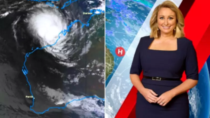
Currently positioned off the coast near Broome in Western Australia, Narelle has undertaken an exceptionally long path that literally spans from one side of the country to the other. This remarkable trajectory highlights the cyclone's persistent and far-reaching nature.
Re-Intensification and Coastal Threats
Now situated near Broome, Cyclone Narelle is forecast to re-intensify as it moves southwest, posing a significant threat to a vast stretch of the northwest Western Australian coastline over the coming days. The cyclone is expected to remain just offshore, creating a constant danger to coastal communities while generating powerful winds and heavy rainfall.

Meteorological patterns indicate Narelle will change direction later in the week, coinciding with shifts in the coastline itself. This development places areas between Exmouth and Geraldton under close watch for a potential eventual landfall.
Wind, Rain, and Weakening Patterns
As Cyclone Narelle continues its movement over water, it brings substantial wind and precipitation concerns. Even when it eventually crosses land and weakens—deprived of its primary fuel source from ocean waters exceeding 26 degrees Celsius—the system will still produce damaging winds and significant rainfall for affected regions.
The impact zone appears extensive across Western Australia, with forecasts predicting more than 50 millimeters of rain for Perth and surrounding areas on Friday and Saturday. Some weather models suggest the capital could receive even more substantial downpours exceeding 100 millimeters during this period.
Southeast Weather Developments
Meanwhile, significant rainfall is also anticipated across parts of southeastern Australia in the coming week. Far eastern Victoria and southeastern New South Wales may experience impacts from a developing low-pressure system from Friday into Saturday, potentially delivering more than 50 millimeters of precipitation.
This weather event will be accompanied by a burst of cold air, providing an early taste of winter conditions. Authorities have issued warnings for sheep graziers due to the expected combination of cold temperatures, wet conditions, and strong winds.
By late Thursday, southeastern Australia will experience a rapid transition from warm, humid conditions to bitterly cold weather. Snowfall is likely across the alpine regions of Tasmania, Victoria, and New South Wales, marking a dramatic seasonal shift for these areas.