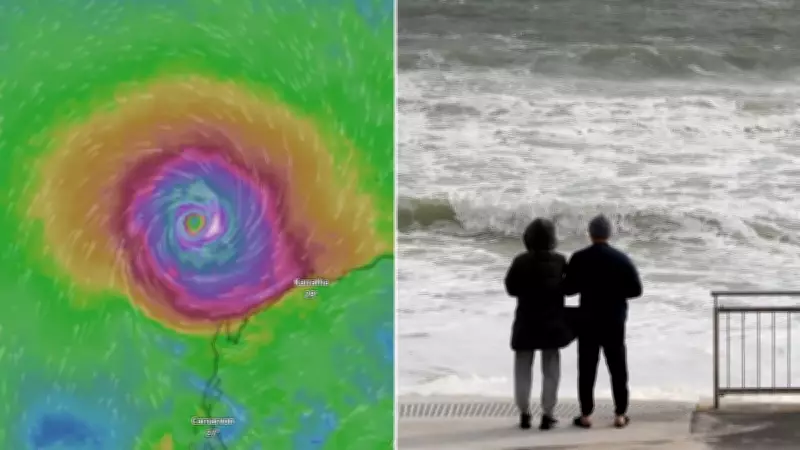
Cyclone Narelle Upgraded to Category 3 as It Approaches Western Australia
Cyclone Narelle has rapidly intensified into a severe Category 3 tropical cyclone, posing a significant threat to Western Australia's southwest region. The storm, which initially formed off the far north Kimberley coast, is expected to bring destructive weather conditions to coastal areas over the coming days.
Storm Path and Intensification Forecast
The Bureau of Meteorology reports that Cyclone Narelle is currently moving parallel to the coastline, with predictions indicating it will curve south towards the west coast. Meteorologists anticipate the system will reach Category 3 strength by late Wednesday or early Thursday, as it travels over waters north of the Pilbara region.
This redevelopment follows the cyclone's earlier impact on far north Queensland and the Northern Territory, where it brought heavy rainfall before moving westward.

Severe Weather Warnings Issued
Authorities have issued multiple severe weather warnings for extensive areas of Western Australia:
- Damaging wind gusts up to 100km/h are expected along the coast between Bidyadanga and De Grey from Wednesday morning
- Gale-force winds will extend westward to Port Hedland and Karratha later on Wednesday
- Wind speeds may increase to 120km/h from Exmouth on Thursday afternoon, reaching Cape Cuvier by Friday morning
- Destructive gusts reaching 140km/h could develop near Karratha late Wednesday or early Thursday, spreading to Exmouth and Coral Bay through Thursday and Friday
Widespread Rainfall and Coastal Impacts
The cyclone will bring extensive precipitation across multiple regions:
- Showers and gusty thunderstorms will affect the Kimberley, Pilbara, Interior, Gascoyne, Goldfields, Eucla, and northern/eastern South West Land Division
- Heavy rainfall is particularly likely along the southwest Kimberley coast and adjacent Pilbara coast
- Large waves may cause minor flooding in low-lying coastal areas
Windy conditions are forecast to persist over the western Kimberley, much of the Pilbara, northwest Interior, and Eucla regions throughout the weather event.
Extended Forecast and Regional Impacts
Cyclone Narelle is projected to continue moving south-southeast during Friday and Saturday, with impacts extending along the Gascoyne coast. The Lower West region, including Perth, may experience effects over the weekend, though precise timing and severity remain subject to the storm's trajectory.
The severe weather has already prompted event cancellations across Western Australia, with organizers citing safety concerns and potential fuel supply disruptions. Residents are advised to monitor official updates from the Bureau of Meteorology and follow all emergency preparedness guidelines as Cyclone Narelle approaches.