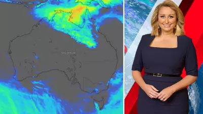
Tropical Cyclone Luana has been officially named as it barrels towards the Western Australia coastline, with the Bureau of Meteorology issuing urgent warnings for residents in the northwest Kimberley region.
Cyclone Intensification and Expected Landfall
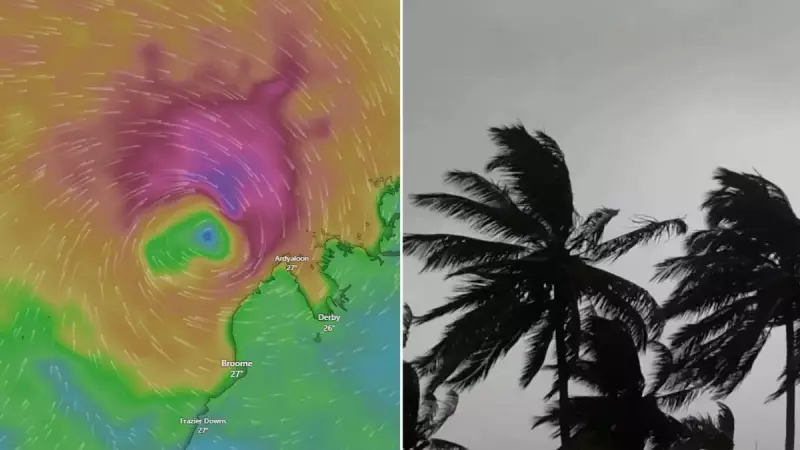
The category 1 system is forecast to intensify significantly before crossing the northwest Kimberley coast later today as a more powerful category 2 cyclone. Senior meteorologist Jonathan How confirmed the development, stating, "A tropical low off the northern coast of Western Australia strengthened overnight and was named Tropical Cyclone Luana this morning."
Currently positioned approximately 250 kilometres northwest of Broome, the cyclone is tracking southeastward, prompting the Bureau to activate a tropical cyclone warning stretching from Broome up to the northeast of Kuri Bay. This warning area importantly includes Derby and several adjacent inland communities that could face severe impacts.

Warning Areas and Expected Impacts
A separate tropical cyclone watch has been established extending from Bidyadanga up to Broome, covering additional inland areas as a precaution. How emphasised that coastal regions are already experiencing building wind gusts, with gales and damaging winds expected to strengthen throughout the day, particularly within the designated warning zone.
"We are expecting Tropical Cyclone Luana to intensify into a category 2 system before making landfall on the northwest Kimberley Coast this afternoon," How stated, highlighting the system's rapid development.
Forecast Path and Potential Double Landfall
After its initial landfall, meteorological models suggest Luana may move back over the waters of King Sound, where it could maintain category 2 intensity before potentially making a second landfall near Derby on Saturday night. This unusual path increases the duration of severe conditions for affected communities.
How explained, "From this, it will start to weaken below Tropical Cyclone strength during Sunday morning after it moves inland and over the Kimberley," indicating relief may come by the weekend's end.
Dangerous Conditions Expected
Tropical Cyclone Luana is predicted to bring multiple hazards to the Kimberley region, including dangerous storm tides, intense rainfall, and destructive wind gusts. Coastal residents within King Sound face particular risk from potentially dangerous storm tides as the cyclone passes overhead.
Tides could rise significantly above normal high tide levels, accompanied by damaging waves and dangerous flooding that may inundate low-lying areas. "We could even see destructive wind gusts of up to 155km/h right near the centre of the cyclone where it does cross," How warned, underscoring the system's ferocity.
Rainfall and Flooding Concerns
Heavy rainfall represents another significant threat, with the potential to cause flash flooding across the northwest Kimberley district. This precipitation could lead to road closures and isolation of communities, with How noting, "We also do have a flood watch current" in addition to the cyclone warnings.
Residents in affected areas are strongly advised to stay informed through official channels and follow all emergency service advice as conditions develop. The Bureau of Meteorology will issue its next Forecast Track Map at 9:00 am AWST on Saturday, providing updated guidance on Luana's movement and intensity.