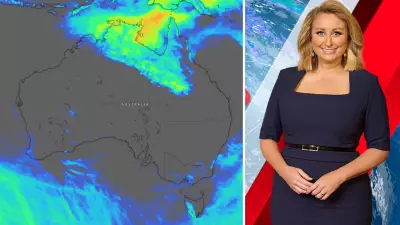
Emergency services and residents across Western Australia's Kimberley region are beginning a major clean-up and damage assessment after Tropical Cyclone Hayley made a destructive landfall, bringing severe winds and heavy rainfall.
Landfall and Immediate Impact
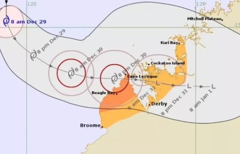
The Bureau of Meteorology confirmed the system crossed the coast as a category three cyclone on the Damper Peninsula around 5pm on Tuesday. While it had weakened from a category four system boasting winds of 220km/h, it remained a powerful force. Senior meteorologist Miriam Bradbury stated the storm still packed damaging gusts exceeding 150km/h as it moved ashore.
Residents in the Lombadina community at Cape Leveque bore the brunt of the cyclone's fury. Reports confirmed that two homes lost their roofs entirely amidst wind gusts reaching 157km/h. The area was also drenched, with 131.8mm of rain recorded. "Around the time of crossing we did see significantly windy conditions and we've seen quite a lot of rain in the area as well," Ms Bradbury said on Wednesday.

Widespread Damage and Community Response
The cyclone's path left a trail of disruption beyond Lombadina. A wind gust of 137km/h was recorded at Yampi Sound, and falling trees were reported across the region. The severe weather triggered widespread power outages, cutting electricity to many homes and businesses.
At least nine people were forced to seek official shelter in Broome, with many more relocating to stay with family and friends ahead of the storm. Local businesses reported substantial damage. James Brown, managing director of Cygnet Bay Pearl Farm, told the ABC that "there's definitely some damage," noting roof damage to structures and trees down everywhere. He estimated it would take days to clear roads and assess the farm's condition.
System Weakens but Warnings Remain
As of Wednesday, Cyclone Hayley was moving eastwards and weakening significantly. The BoM advised it had been downgraded to a category one system, located approximately 90km north-east of Derby. However, authorities cautioned that dangerous conditions were not yet over.
"It will continue to weaken today, however, it could still produce destructive winds in coastal communities," Ms Bradbury warned. A tropical cyclone warning remains current for areas north-east of Derby, south-east of Cockatoo Island and west of Mount Barnett, where damaging wind gusts up to 100km/h are possible.
A separate severe weather warning for heavy rainfall is also in effect for parts of the far northern Kimberley, with forecasts of 40-60mm of rain in six hours and potentially higher isolated falls. The Department of Fire and Emergency Services (DFES) and Horizon Power have deployed aircraft to survey the damage from the air and direct ground crews to critical repair sites.