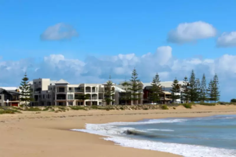
The City of Mandurah has adopted a coastal hazard risk management plan that could ban coastal property owners from developing or subdividing their land while also facing higher rates. The Southern Beaches coastal hazard risk management and adaptation plan was approved 10-2 by the council at its April 28 meeting, aiming to address erosion, rising sea levels, flooding, and severe storms along the ocean-facing coastline from Roberts Point in Halls Head to the city's southern boundary in Clifton.
Key Recommendations of the Plan
The plan proposes establishing a special control area over all land deemed vulnerable to coastal erosion or inundation. Within this area, planning approval would be required for all proposed developments, including those that currently do not need approval. Non-habitable buildings and minor extensions may be exempted. Additionally, grouped and multiple dwellings would be prohibited, even if permitted under existing planning rules.
The plan acknowledges potential community concern, particularly among landowners, but emphasizes that there is no government obligation to compensate for land lost due to coastal hazards. It states, "It is much more proactive for the city to identify land at risk in the future and take appropriate action." Landowners are cautioned not to assume any funds will be forthcoming for future adaptation or retreat.

Coastal Management Fund
Another recommendation is the creation of a coastal management fund, funded by a special rate or levy equivalent to 1 to 2 percent of the city's budget. A benefit distribution analysis would determine if certain parties benefit more and should contribute more, reducing the financial burden on other ratepayers.
Council Concerns Over Property Rights and Costs
The erosion of property rights and potential costs sparked concern among some councillors. Cr Ryan Burns worried about planning controls being overridden, noting that recommendations include prohibiting subdivision and higher density development, requiring approvals for work that normally wouldn't need them, introducing time-limited approvals, and placing notifications on property titles. "These are not minor measures," he said. "They have real implications for property rights, land value, and how people can use the land they already own."
Cr Owen Mulder could not support the plan without knowing its cost. He highlighted that the coastal management fund would require raising rates to collect an additional $2 to $3 million per year, with a differentiated funding arrangement where some residents and businesses pay more. He cited incomplete costings showing multi-million dollar costs, such as $10.5 million every 10 years for beach sand nourishment at Blue Bay.
Cr Jacob Cumberworth advocated for protection work and state and federal support, noting the "phenomenal cost" but arguing that tens of millions pale in comparison to the capital value of coastal properties, which exceeds a billion dollars. He warned that losing coastline could erode confidence in the city.
Cr Peter Jackson praised the plan but questioned funding sources, stating, "I don't see where the money is going to come from." Deputy mayor Jess Smith said the only alternative seemed to be doing nothing, and described the document as a guide for managing coastal hazards and ensuring long-term sustainability.
Director's Clarification
Director built and natural environment Matthew Hall clarified that the plan does not commit the city to costs beyond developing a 10-year action plan. The action plan would detail potential costs, requiring council decisions reflected in the long-term financial plan and future annual budgets. He noted the plan is necessary to seek state and federal funding, similar to previous plans that secured funds for foreshore protection at Doddi's Beach and Town Beach seawall repairs.
Public Consultation and 4WD Access
The plan received 45 submissions during public consultation in December and January. Thirteen submissions opposed closing beach access for 4WDs, with many viewing visiting and fishing at 4WD-accessible beaches as a "local way of life" and a tourism asset. Suggestions to manage 4WD behavior included signage, speed limits, infringements, enforcement during peak times, and dune access barriers.

The plan's recommendations do not restrict access but defer to the Yalgorup National Park concept master plan from 2024, which suggests making the beach from North Rocks carpark to Whitehills Beach carpark vehicle-free, with north-south movement via unsealed tracks in the dunes. The Shire of Waroona called for maintaining 4WD beach access and a collaborative approach between the shire and city.
One submission acknowledged issues with dunes being driven on by "intellectually challenged 4WD owners" and suggested offsetting costs with an access pass. Another submission expressed skepticism, stating the council would "make up bulls... to do what they want," while another emphasized that beach access has been a "rite of passage" for Mandurah citizens since the city's founding.