
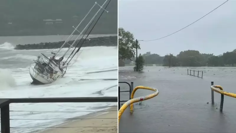
Queenslanders are facing a renewed threat of dangerous flash flooding as the remnants of the state's first cyclone of the year, Ex-Tropical Cyclone Koji, continue to dump torrential rain on already saturated catchments.
Record Rainfall and Widespread Warnings
The system, which crossed the coast as a low near Bowen south of Townsville on Sunday morning, has delivered staggering rainfall totals. Mount William recorded a colossal 598 millimetres of rain from 9am Saturday to 6am Monday, while Clarke Range, inland from Mackay, received 362mm in just 24 hours to 9am Sunday.
As of Monday, the weakening low is situated over the northern Central Highlands and Coalfields, moving slowly northwesterly. However, the Bureau of Meteorology (BOM) has issued a severe weather warning for heavy, life-threatening rainfall and flash flooding stretching from Mackay up to Gladstone and into parts of the central west.

Immediate Dangers and Community Impact
Senior meteorologist Christie Johnson highlighted the acute risk of flash flooding as the primary concern. "We've got very saturated grounds... and the rivers and creeks and streams will respond really quickly," Johnson warned. The BOM forecasts six-hourly rainfall totals of 80mm to 150mm within the warning zone, with 24-hourly totals potentially reaching 150mm to 250mm and isolated falls exceeding 340mm.
Multiple flood warnings are current as rivers swell and breach their banks. The BOM has also cautioned about an increased risk of landslips and falling trees due to the sodden landscape. "Landslips could also occur about steep and hilly terrain," the bureau advised.
Extended Threat and Future Uncertainty
The moisture from Ex-Tropical Cyclone Koji is also influencing weather patterns further south. The risk of thunderstorms, which could tap into this moisture and produce intense localised rainfall, extends down into Wide Bay, Burnett, and possibly the Sunshine Coast and its hinterland.
By Tuesday, this thunderstorm and heavy rainfall risk is forecast to spread across most of southeast Queensland, including Brisbane and the Gold Coast. While the system is expected to track over northwest Queensland and into the Northern Territory, BOM notes a slight, 10 to 15 per cent chance it could move off the coast north of the Kimberley and redevelop into a tropical cyclone over water.
This event echoes the behaviour of Cyclone Steve in 2020, which traversed northern Australia, reforming multiple times. Authorities urge residents in affected regions to stay updated with official warnings and avoid floodwaters.


