Adelaide's Record Dry Summer Set to Break with Major Rain Event
Adelaide has endured an exceptionally dry start to 2026, but a major rain event is now looming for drought-stricken parts of South Australia. The Bureau of Meteorology has issued warnings for heavy falls and thunderstorms expected to sweep across the state from Sunday, bringing much-needed relief to parched regions.
Historic Dry Spell Nears All-Time Record
The city has recorded just 3.4 to 3.6 millimetres of rain since January 1, following only 2.8 millimetres in December. This brings the total for the 2025–26 summer to a mere 6.2 millimetres as of February 17, which is alarmingly close to the all-time record set in 1905–06 when only 4 millimetres fell across the entire season. The prolonged dry conditions have exacerbated drought impacts, particularly in northern areas of the state.
Unusually Warm Temperatures Compound the Issue
Minimum temperatures have also been unusually warm, with January mean minimums sitting 0.9 to 2.5 degrees Celsius above average across Adelaide and the Hills. The heat peaked again on February 16, when the city hit 37.3 degrees Celsius, followed by an uncomfortable night where temperatures hovered above 30 degrees Celsius well after midnight. This combination of heat and dryness has left landscapes parched and communities eager for rainfall.

Previous Rainfall Attempts Fall Short
Earlier in the week, a rainband crossed the state, raising hopes for a proper soaking. However, most suburbs missed out on significant precipitation. While Auldana on the eastern fringe of the city collected 10.8 millimetres in just 15 minutes, and some inner-northern suburbs saw 10 to 15 millimetres in brief storms, the majority of Adelaide recorded less than a millimetre, with many areas receiving no rain at all.
Significant Rainfall and Thunderstorms Expected
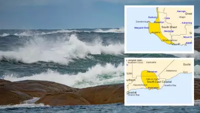
The Bureau of Meteorology now predicts that a real change will arrive from Sunday, with significant rainfall and thunderstorms expected to sweep across the state's north and continue well into next week. Forecasters indicate that there is also a risk of meaningful rain across Adelaide and other southern districts on Sunday, depending on how the system develops over the next 48 hours. Parts of Adelaide are anticipated to receive between 2 and 15 millimetres of rain in a matter of hours.
Flood Watch Issued for Vast Areas
A Flood Watch has been issued for extensive regions including Oodnadatta, Coober Pedy, Woomera, Roxby Downs, William Creek, the Flinders Ranges, and Moomba. Dry creek beds and parched catchments in these areas could respond quickly to heavy falls, increasing the risk of flash flooding. Emergency services are on high alert as the impending deluge threatens to transform drought conditions into hazardous water events.
Emergency Services Urge Preparation
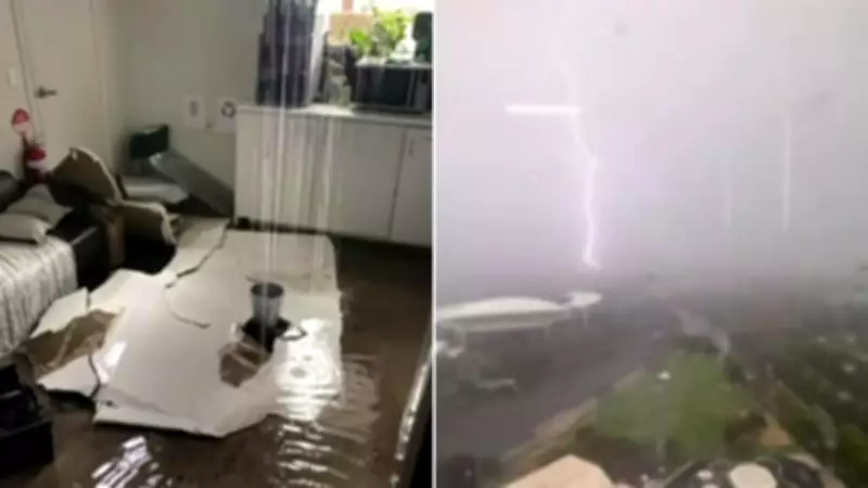
The State Emergency Service is urging residents to clear roof gutters ahead of the change, warning that blocked drains could lead to stormwater entering homes. Heavy rain earlier this week triggered a spike in SES callouts for water damage, and authorities fear many gutters remain clogged after months of dust, leaves, and debris. With Adelaide still waiting for its first proper soaking of the year and drought-hit northern regions bracing for a deluge, emergency crews emphasise that preparation now could prevent costly damage later.
As the community prepares for this significant weather event, the focus remains on safety and mitigation. The coming days will be critical in determining whether this rain event brings much-needed relief or poses new challenges for South Australia.