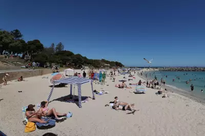
For several years, a peculiar stone pathway stretching along the rocky shoreline at Long Nose Point, Barlings Beach near Broulee on the New South Wales South Coast, has sparked curiosity and wild theories among locals and visitors alike.
Now, the mystery has finally been solved, and the truth is far from the romantic historical guesses it inspired.
The Puzzling Coastal Path
The hand-crafted path, built from rocks and concrete, extends from the sand out along the rocky headland. Its narrow width, barely wider than a wheelchair, and its challenging location right on the water's edge suggested a significant labour of love.

Brett Smith of Jindabyne, a keen scuba diver, was among those baffled. He speculated it might have been privately built to help a wheelchair-bound resident access the ocean. Others, like John Smithers of Kaleen, wondered if it was remnant tourist infrastructure from the mid-1800s, comparing its grandeur to an old Roman road.
Intrigued, columnist and mystery investigator Tim the Yowie Man recently made the trip to Barlings Beach to see the path for himself. He found it impressive, though not quite Roman in scale, and noted it was partially submerged at high tide—an odd feature for a walking track.
Clues Point to the Truth
The investigation took a turn with the discovery of specific features along the path. A large, yellow metal hatch and a saucer-sized air vent embedded in the concrete offered the first real clues. The path ultimately disappeared beneath the ocean waves.
A call to Eurobodalla Shire Council revealed the definitive answer. Council spokesman Duncan McLaughlin explained the path is actually a covering for a functioning effluent pipe from the 1980s.
The pipe runs 1.2 kilometres from the Tomakin Water Treatment Plant, located a few hundred metres inland, and discharges treated wastewater into the ocean about three-quarters of the way out towards the tip of the headland.
"The path was made using a technique called 'cut, drilled and popped'," said McLaughlin. The hatch is an access point for testing and pressure release. While council records from the time are scant, he suggested the design was likely due to engineering, hydraulic considerations, and cost, taking into account tidal flows for dispersion.
Reactions to the Revelation
The path had also puzzled South Coast historian Richard Fisher, who was asked about its 'Roman' origins by beachcombers six or seven years ago. Upon learning its true purpose, he admitted he "thought it was beautifully done."
Not everyone is a fan. Author Helen Moody dismissed it in her 2023 book as "an incongruous man-made concrete and rock pathway." Meanwhile, scuba diver Brett Smith's reaction to the news was less than thrilled: "Just great, where I've been diving for decades! I'm very sorry I asked now."
Tim the Yowie Man concluded that while the structure is undoubtedly man-made, it's more aesthetically concealed than many other sewer outfalls around the country. And yes, he made sure to take his pre-Christmas swim a fair distance away from the outfall point.
A Musical Snake Deterrent
In a related historical note from the region, the column also shares an ingenious 19th-century solution to a common summer problem. At Bluebeards Cottage on the banks of the Murrumbidgee River at Lanyon, residents used a zither—a harp-like musical instrument—as a snake alarm.
Thomas Locker, an overseer at Lanyon from 1838 to 1848, and others placed the instrument in the gap under the door, which was kept open for breeze. Any snake attempting to slither inside would trip over the strings, creating a sound to alert the inhabitants to the intruder.
Thomas's great-great-grandson, Barry Snelson, demonstrated the method with a period-appropriate zither, preserving a clever piece of local bush ingenuity.