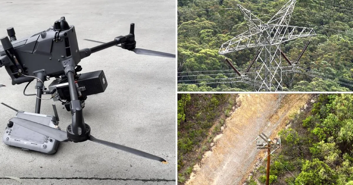
Ausgrid is using drones equipped with high-resolution LiDAR scanning technology to inspect power lines and surrounding vegetation in the Hunter and Central Coast regions. The drones capture millions of data points to create precise 3D models, helping crews identify potential bushfire risks earlier and respond more efficiently.
“Every year we inspect our network to reduce bushfire risk, but how we do that is evolving,” said Junayd Hollis, Ausgrid group executive network and digital. “This technology gives us a clearer, more detailed picture of our assets, while reducing the need for low-flying helicopters over homes, farms and sensitive environments.”
Unlike helicopters, drones can be deployed in localised areas, reducing noise impacts and minimising disruption to livestock and agricultural operations. They also offer lower operational costs and reduced emissions while improving inspection accuracy and efficiency.

NSW Rural Fire Service Hunter Area Commander Chief Superintendent Kam Baker emphasised that preparation is a shared responsibility. “Bushfires pose a very real risk to the Hunter and Central Coast regions, and electricity infrastructure can exacerbate that risk if it isn't properly maintained, that's why this program is critical,” he said.
The program, which began in April, is assessing thousands of kilometres of Ausgrid's network in bushfire-prone areas across Sydney, the Central Coast and the Hunter. It combines aerial, drone and ground-based patrols to evaluate network safety and identify vegetation hazards. Ausgrid is partnering with Service Stream for on-the-ground inspections, including checks of private power poles and overhead lines.