The United Nations has issued a stark warning that the world must prepare for the imminent return of El Niño, a powerful natural weather pattern that supercharges weather extremes. According to the World Meteorological Organization (WMO), there is an 80% chance of El Niño forming before September and a 90% chance before November.
El Niño's Expected Strength
The WMO reported that most models project the return of this cyclical phenomenon to be at least moderate in strength, with some models indicating a possibly strong event. However, the organization stopped short of backing projections that it could be the strongest this century, noting a window of uncertainty. Celeste Saulo, the WMO Secretary General, stated, "The spread is large. There are models that are not providing any indication of a strong El Niño, while others are doing so."
Global Impacts and Urgent Warnings
UN Secretary General António Guterres emphasized the urgency, saying, "El Niño conditions will pour fuel on the fire of a warming world. Impacts will hit even harder, travel even farther, and cross borders with devastating speed." The most recent El Niño, which occurred in 2023-24, was one of the five strongest on record and contributed to record-breaking global temperatures in 2024.

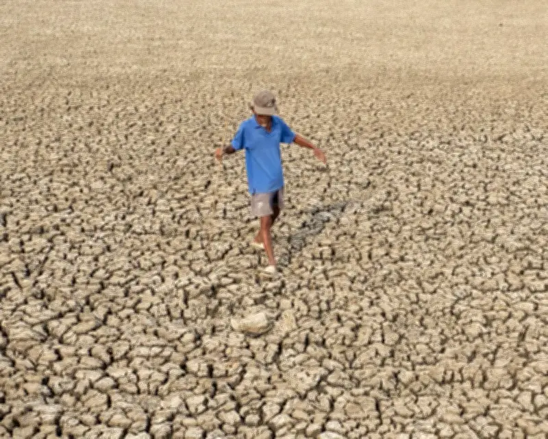
The WMO forecasts unusually high temperatures across nearly all parts of the planet for the next three months and warns of a greater probability of extreme rain and drought. While each El Niño event is unique, scientists typically associate it with heavier rain in parts of South America, the southern US, the Horn of Africa, and central Asia, and drier conditions in Central America, northern South America, the Caribbean, Australia, Indonesia, and parts of south Asia.
Fuel for Hurricanes and Heat
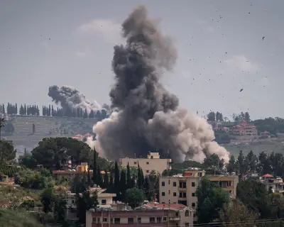
The warm waters associated with El Niño can fuel hurricanes in the central and eastern Pacific Ocean but hinder their formation in the Atlantic basin. The warning comes as western Europe experiences an unusually hot May, with temperature records broken in the UK and Ireland. The WMO and the UK Met Office have previously warned that a record-breaking hot year is almost certain before the end of the decade, with the expected return of El Niño likely to accelerate this to as soon as 2027.
Threat to Food Supplies
Gareth Redmond-King from the Energy & Climate Intelligence Unit highlighted the threat to food supplies, which are already under strain from climate breakdown and disruptions to fertiliser flows due to the Iran war. "The havoc El Niño will wreak as it likely delivers another hottest year, in 2027, will be devastating for many farmers, and a question of life or death for far too many people," he said.
El Niño Conditions and Early Warning Systems
El Niño conditions occur every few years and last around nine to 12 months. During such years, winds that push warm waters to the west weaken or shift direction, allowing surface waters in the Pacific to warm. The WMO reported that sea surface temperatures in parts of the Pacific approached El Niño thresholds in late April to mid-May, fed by unusually warm subsurface conditions. The atmospheric component of El Niño was also consistent with its development.
The WMO rejected the term "super El Niño," which some scientists have used, as it falls outside the official classification system. Early-warning systems have saved lives even as fossil fuel pollution has made extreme weather more violent. However, major foreign donors, including the UK and US, have cut their aid budgets in the last year. Saulo noted, "Climate finance is not at its peak, but early-warning systems have been and still are a priority. We still need more resource mobilisation to fund those countries that need support."
Guterres concluded, "The only effective response is climate action equal to the crisis – ending the addiction to fossil fuels, accelerating the shift to renewables, protecting the most vulnerable, and delivering early-warning systems for all."