A tropical low, designated 12U, is moving from the Coral Sea toward the Far North Queensland coast, with forecasts indicating it will move inland over the weekend. The Bureau of Meteorology (BOM) has issued a severe weather warning for heavy rainfall and damaging winds for parts of the North Tropical Coast, from north of Hope Vale to Hamilton Island.
The BOM estimates a 15% chance of the low developing into a tropical cyclone from Thursday night, increasing to 45% from late Friday. Regardless of cyclone formation, heavy rainfall is expected, with locally intense falls exceeding 250mm possible, leading to dangerous and life-threatening flash flooding.
Recent rainfall has already impacted the region, with Garradunga recording 227mm and areas near Babinda nearly 200mm in the 24 hours to 9am. Cairns Racecourse recorded 77mm. Six-hourly totals of 100–150mm are likely, with isolated falls over 200mm possible, according to BOM modelling.

Senior meteorologist Laura Boekel warned that heavy rainfall would continue after the system moves onshore, bringing tropical moisture that could cause life-threatening flash flooding and riverine flooding. Flood watch warnings have been issued for numerous communities, including Cairns, Townsville, and the Whitsunday Islands.
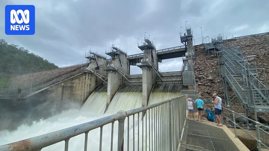
In preparation, Townsville City Council released water from the Ross River Dam to reduce flood threats. Mayor Nick Dametto advised residents to prepare cyclone kits with radios and batteries. Meanwhile, councils in north-west Queensland have criticized flood warning infrastructure as outdated and inadequate, with gaps in real-time monitoring putting communities at risk.