A powerful cold front is set to sweep across South Australia on Monday, bringing with it damaging wind gusts reaching up to 100km/h. The Bureau of Meteorology (BoM) has issued warnings for severe weather conditions across several regions.
Wind and Weather Details
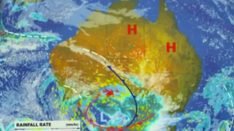
According to Sky News Weather meteorologist Tamsin Green, the south of the country will bear the brunt of the impact, with strong winds, showers, and thunderstorms expected. Wind averaging 60 to 70 km/h, with gusts of up to 100 km/h, is possible across the West Coast, Eyre Peninsula, and Yorke Peninsula on Monday afternoon.
Residents in affected areas are advised to take precautions: move vehicles under cover or away from trees, secure or store loose outdoor items, and remain indoors away from windows while conditions are severe.

National Forecast
The weather system, which previously lashed Western Australia with destructive gusts and heavy rainfall, is now moving eastward. Conditions in Western Australia are expected to ease as the front progresses.
In Brisbane, high pressure will bring settled, sunny, and dry weather with a top of 22C. Sydney will see a sunny day with a slight chance of a shower at night, reaching 19C. Melbourne will be cool, cloudy, and showery, with winds ramping up through the day and a high of 14C. Adelaide faces the severe weather warning with strong winds, showers, and a possible thunderstorm, reaching 20C. Canberra and Hobart will start mainly dry but see blustery showers later, with highs of 13C each. Perth will have a windy start easing during the day, with showers likely and a high of 19C. Darwin remains sunny and clear with a high of 31C.
Key Safety Advice
- Move vehicles under cover or away from trees.
- Secure or store loose outdoor items.
- Stay indoors away from windows during severe conditions.
Green emphasized the widespread severe weather threat along the south of the country, while the north enjoys fine and settled weather under high pressure.