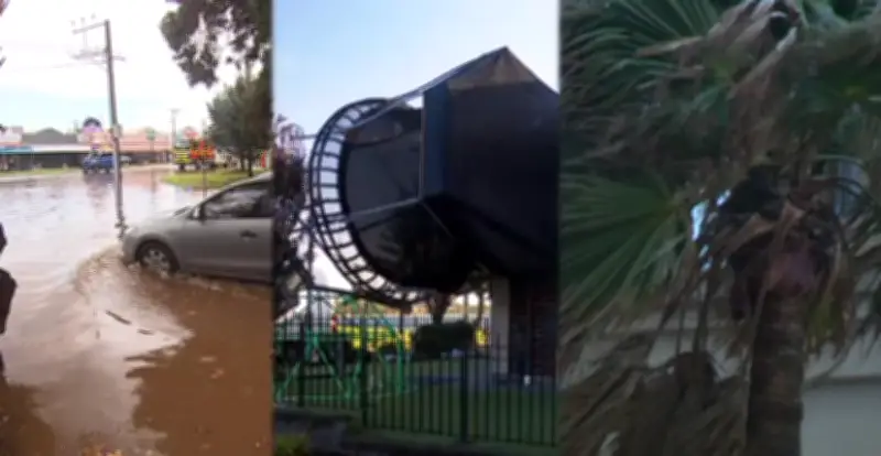
The wrath of a winter blast made a significant impact during the first four days of the season across South Australia. Damaging winds tore up trees, leading to hundreds of emergency services callouts from Monday to Wednesday. Abnormally high tides on Tuesday created dangerous conditions along the state's coastlines.
Cold Temperatures and Flooding
Temperatures plunged on Wednesday, with several areas recording the coldest day of the year. Adelaide reached just 15.4C. Heavy rainfall resulted in flash flooding and damage to homes.
The Mount Lofty Ranges and coastal fringes bore the brunt of the rain, with some areas already recording close to the monthly average. In the last seven days, more than 100mm of rain has fallen at Ashton, Crafers West, Lenswood, Mount Lofty, and Uraidla. Almost 150mm fell at Woodhouse, while Adelaide collected 49mm. The average for June in the SA capital is 72mm.

Rural Rainfall Totals
South Australia's rural areas also collected healthy totals: Melrose 60mm, Auburn 61mm, Brinkworth 89mm, Saddleworth 72mm, Parndana 51mm, Maitland 63mm, Kingston 84mm, and Lucindale 56mm.
High tide resulted in waves smashing into the Henley Beach jetty on Tuesday afternoon. Flooding was also reported at Glenelg on Tuesday.
Drier Areas
Not every area did well, with less than 10mm recorded at: Murray Bridge 8mm, Renmark 7mm, Cowell 3mm, Tumby Bay 5mm, Hindmarsh Island 6mm, and Pinnaroo 3mm.
Forecast for the Long Weekend
So what's next? The June long weekend forecast has relatively nice conditions, considering what we've just had. A large, slow-moving high-pressure system is moving into the picture, bringing a return to more stable conditions. Lighter winds, tending more northerly, will result in warmer temperatures. Many parts of the state can expect top temperatures up around twenty degrees early next week. There is still a chance of showers, but they will be much lighter and more scattered.
Then there is potential for the next rain system and cold front mid-next week, but that is unlikely to produce too much rain inland, instead sticking to coastal fringes. Despite the soggy start to winter, long-range forecasts still indicate a below-average June to August rainfall across southern Australia, according to the Bureau of Meteorology's outlook.