It has been a wet week across much of Australia, with every state and territory recording rainfall in the past seven days. More rain is expected over the next few days as weather systems continue to push across the southern parts of the country.
Weather Systems Bring Heavy Rain
With no high pressure system in sight to act as a blocker, these lows have had free rein, leaving the door open for tropical moisture to feed in from the north. This has given each system an extra punch, pushing rainfall totals higher.
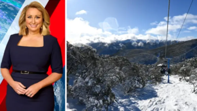
Alps Frustrated by Rain, But Change Coming
The alpine region has experienced a frustrating season so far. The track of these weather systems has kept the alps on the warm side of the lows, delivering rain rather than snow for the resorts. However, that is about to change. Later on Thursday, the wind direction shifts from a northerly airflow, which has been keeping temperatures mild, to a colder westerly. With this shift comes the potential to blanket the alps in snow. It may not fix everything overnight, but it is the change skiers and snowboarders have been waiting for.

High Pressure Brings Sunny Days Next Week
After the system passes, the pattern settles down significantly. High pressure moves back into the southeast over the weekend and looks likely to linger through much of next week. This is great news for the second week of school holidays. The forecast includes cold, crisp nights followed by days full of sunshine, and not just one but several of them in a row. Whether you are in Melbourne, elsewhere in Victoria, or heading up to the snow, that is about as good a forecast as you could hope for at this time of year, especially for those in flooded areas that need to dry out.